2025 with the transformation of Lang Son Geopark Tourism (Lang Son province, Viet Nam)
Spanning over a vast territory of 4,842.58 km2, Lang Son Geopark is a hidden gem in the mountains of northern Vietnam. It is a living testament, encapsulating in its diverse landscapes with the journey through 500 million years of life's evolution. ancient seas and volcanic lands to ironwood forests, each facet of the Geopark tells a unique story. The Geopark is a vibrant tapestry of ethnic diversity, with each ethnic group contributing unique customs and traditions. The spiritual life of the Geopark is deeply rooted in Dao Mau, a UNESCO-recognized Mother Goddess Worship religion. The harmonious combination of natural history, cultural diversity and spiritual traditions makes Lang Son Geopark a unique destination to explore. It is considered a beacon for sustainable development, a tribute to the resilience of nature and culture. On September 8, 2024, within the framework of the 8th International Conference of the UNESCO Global Geoparks Network in the Asia-Pacific region, the UNESCO Global Geoparks Council Meeting conducted an assessment and vote, 100% of the members agreed to recognize Lang Son Geopark as a UNESCO Global Geopark. In April 2025, UNESCO officially added the List of Lang Son Global Geoparks on the Organization's Website. It is expected that in September 2025, Lang Son province will officially receive the Certificate of recognition of the title of Lang Son UNESCO Global Geopark in the Republic of Chile.
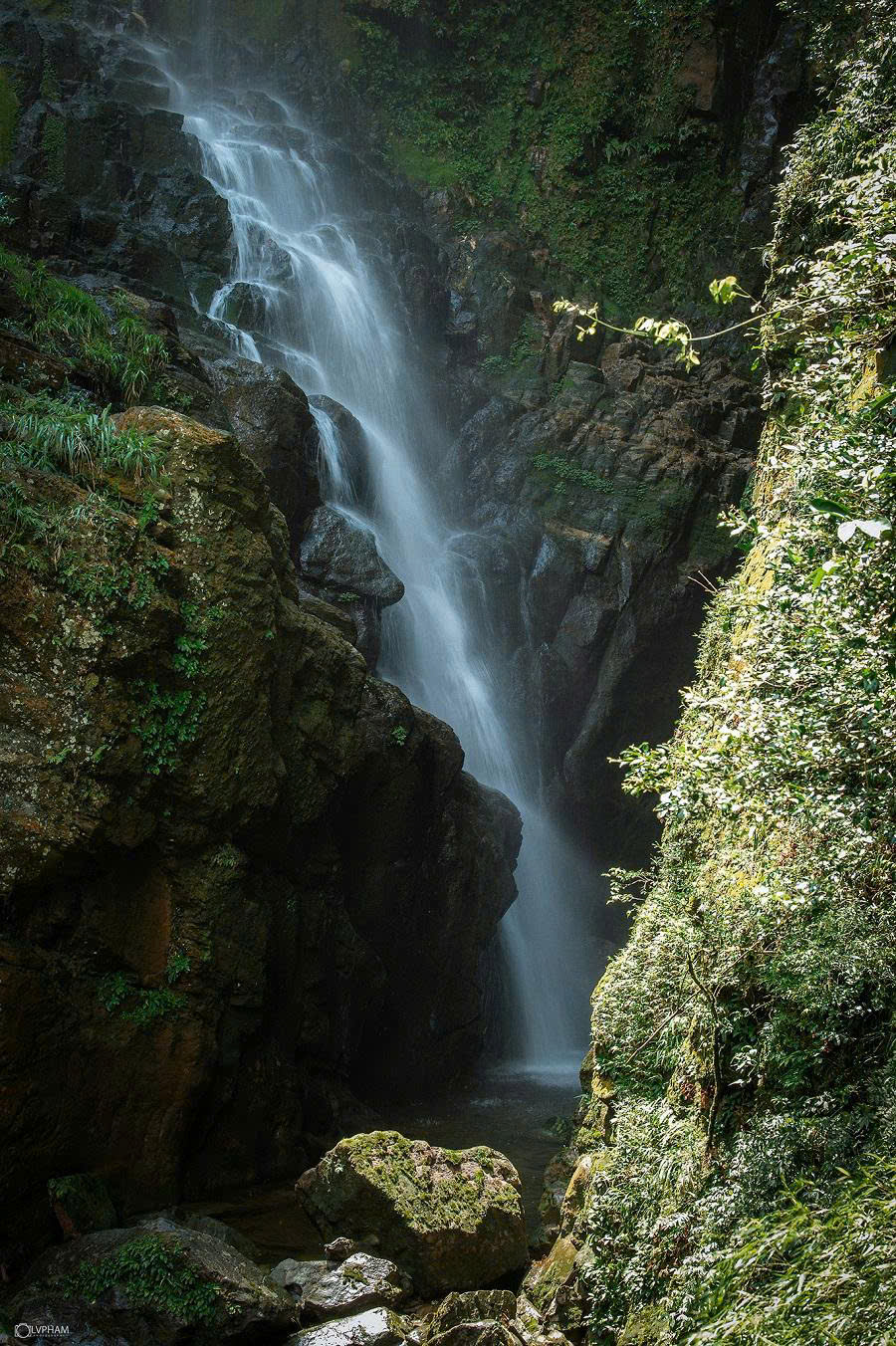
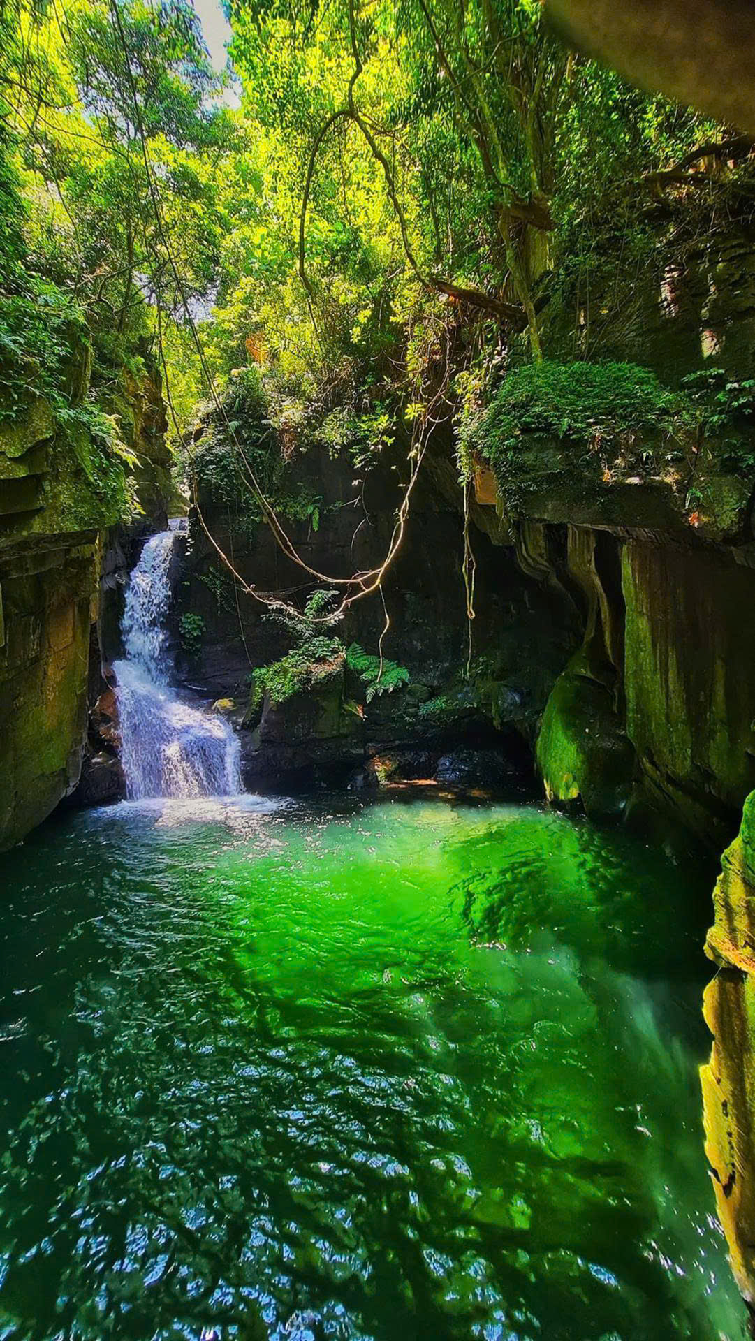
As of 2024, there have been 213 geoparks in 49 countries that are members of the UNESCO Global Geoparks Network. Many UNESCO Global Geoparks have effectively ultilized the Geotourism model for regional economic development. Geotourism is a type of tourism that focuses on exploring and experiencing geological sites around the world, including geological landscapes, special geological areas, geological heritages, geological phenomena and geological resources. Geotourism sites may include volcanic areas, karst landforms, sinkholes, rivers and waterfalls, caves and other land areas with unique and attractive geological features for tourists. Geotourism also emphasizes the protection and management of geological resources to ensure sustainability and maintenance for future generations. Lang Son Geopark has a magnificent natural geological and geomorphological terrain, with about 200 caves, many beautiful waterfalls and sinkholes. This will be a source of inspiration for the development of Geotourism (cave exploration, sport climbing, paragliding, trekking, waterfall, sinkholes, SUB rowing). Coming to Lang Son Geopark, visitors will have mysterious and unique journeys of discovery.
Geotourism - a new direction for Lang Son Geopark tourism, creating significant stimulation contributing to boosting the economy of the region in particular, Lang Son province in general, raising awareness of science and conservation of tourists and local communities. Lang Son Geopark Geotourism will provide visitors with information, knowledge and understanding of the geological, geomorphological and geographical characteristics of a place associated with the protection and sustainable development of the environment, heritage, aesthetics, culture and happiness of the community... Visitors will feel excited when experiencing the beauty and magnificence of geology, topography, geomorphology associated with the culture, history and indigenous religion of the landscapes, thereby helping visitors understand the tangible and intangible values, thereby appreciating and joining hands to protect and preserve the landscapes and geological heritages of Lang Son Geopark. Caves, sinkholes, waterfalls, and majestic natural landscapes of Lang Son Geopark contain countless interesting things that attract visitors and bring memorable experiences.
.jpg)
Hang Hong - Yen Son Heaven Gate or Yen Son God's Eye Mountain: This is the name given by locals and tourists to this limestone mountain with a special shape. This is a mountain with a typical terrain in Huu Lung district where the limestone mountain ranges have steep cliffs and sharp peaks with limestone blocks that have been strongly weathered through the geological tectonic process.
.jpg)
.jpg)
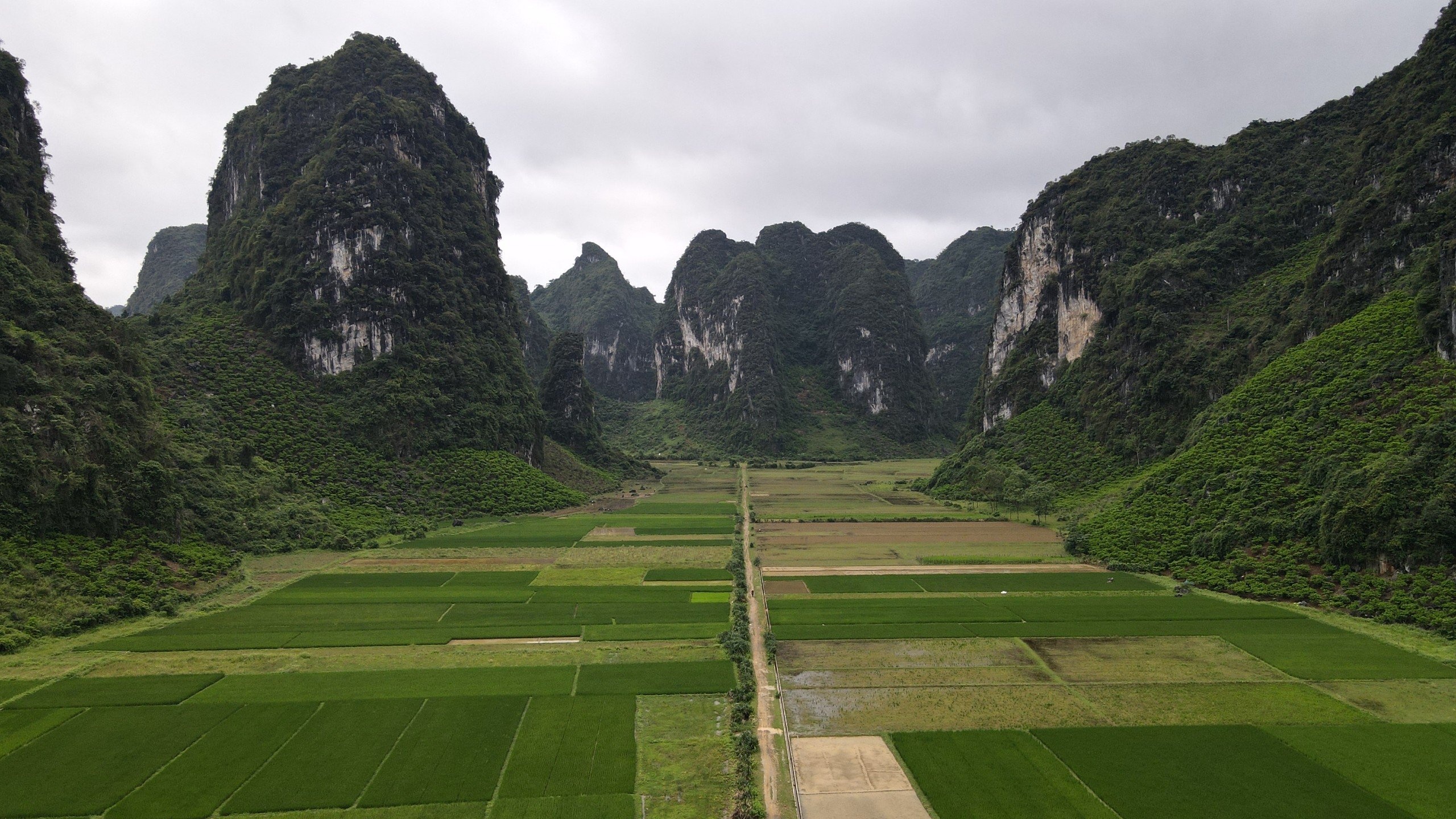
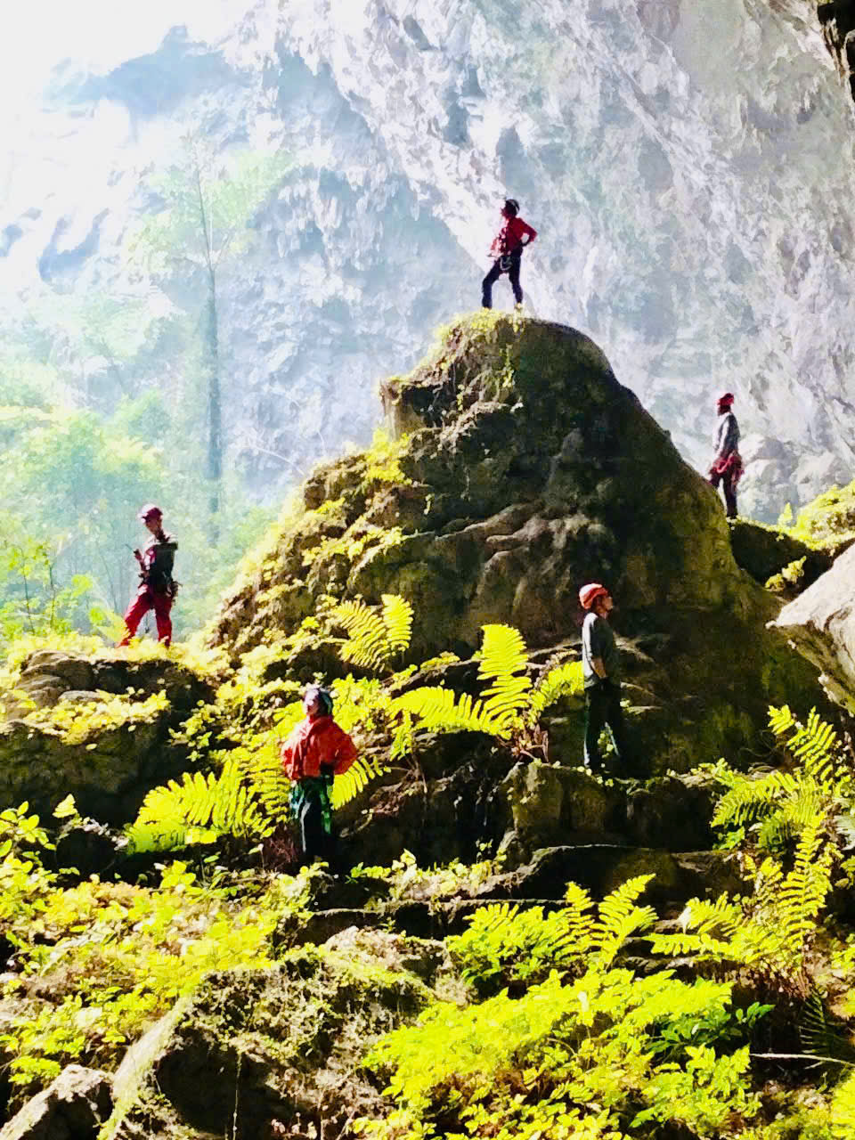
Hang Hong is located about 2.5km National Highway 1A, Cai Kinh to Yen Son Commune People's Committee headquarters. Hang Hong is a dome-shaped cave that penetrates one side to the other side of the mountain, the dome height is more than 60m, located at an altitude of about 80m above the ground and is located in Lan Lua village (Lan Lua: local name - Lan is a local noun describing the valley terrain interspersed between limestone mountain ranges) in Lang Son Geopark. Similar to the terrain of the Eye of God Mountain in Cao Bang province, Hang Hong is actually a dry cave, a fossil cave formed more than 300 million years ago. The cave is located at its current height due to uplift during the neotectonic period, including tower-shaped and cone-shaped mountain blocks interwoven with valleys between limestone mountain blocks. The working group surveyed the trekking route the parking lot to the top of Yen Son Heaven Gate, about 2km long with flat terrain through the local people's custard apple orchard, combined with climbing cat ear rock mountain. The top of Yen Son Heaven Gate is located at an altitude of more than 200m above sea level. At the top, visitors can see the whole view of Lan Lua village, with lush custard apple patches and the winding road to Yen Son commune between the extremely spectacular limestone mountains. The survey team set up a safe rope system to survey the adventurous mountain climbing and rope climbing tour to conquer Yen Son Heaven Gate, with an impressive total rope climbing height of more than 100m.
.jpg)
Khuon Bong Cave, Vu Le Commune, Bac Son District: a very special location when going the cave branch starting Vu Le Commune, Bac Son District. The cave exit is Suoi Mo Ga Cave in Phu Thuong Commune, Vo Nhai District, Thai Nguyen Province. This is a cave that stretches across two provinces, so exploitation will require coordination both sides. The water source flowing Khuon Bong Cave is initially determined to flow Khuon Bong Village the cave through the limestone mountain to flow out towards the Suoi Mo Ga Cave entrance. The length of the initial survey and measurement of the cave is about 2.8 km. Khuon Bong Cave entrance Khuon Bong Village is a small rocky crevice found by local people while catching snakes. This cave entrance is only about 60cm in diameter, enough for one person to enter, inside is a hole about 3m deep. To enter the cave, you need to use a rope and safety belt to ensure safety. When going in another 20m, a deep wall appears, you have to use a rope to go down 60m to reach the cave floor that can be walked. Khuon Bong Cave is a very beautiful water cave with fossil structure, natural stalactites, many lakes and small waterfalls flowing vertically and in the shape of stairs inside the cave, converging a variety of elements serving adventure tourism, cave exploration.
.jpg)
.jpg)
.jpg)
Towards the end of the cave, the stalactite system is extremely developed and intact, so there is a lot of potential to develop adventure tourism. The exit of Khuon Bong Cave connects with Suoi Mo Ga Cave on the Thai Nguyen side, so it will connect the two tourist areas. However, there needs to be coordination both sides of the government. Currently, the exit of Suoi Mo Ga Cave has a very low ceiling, almost touching the water surface, so it is quite difficult to move, it is necessary to have a team of experts and a lot of experience to guide when going through to ensure safety.
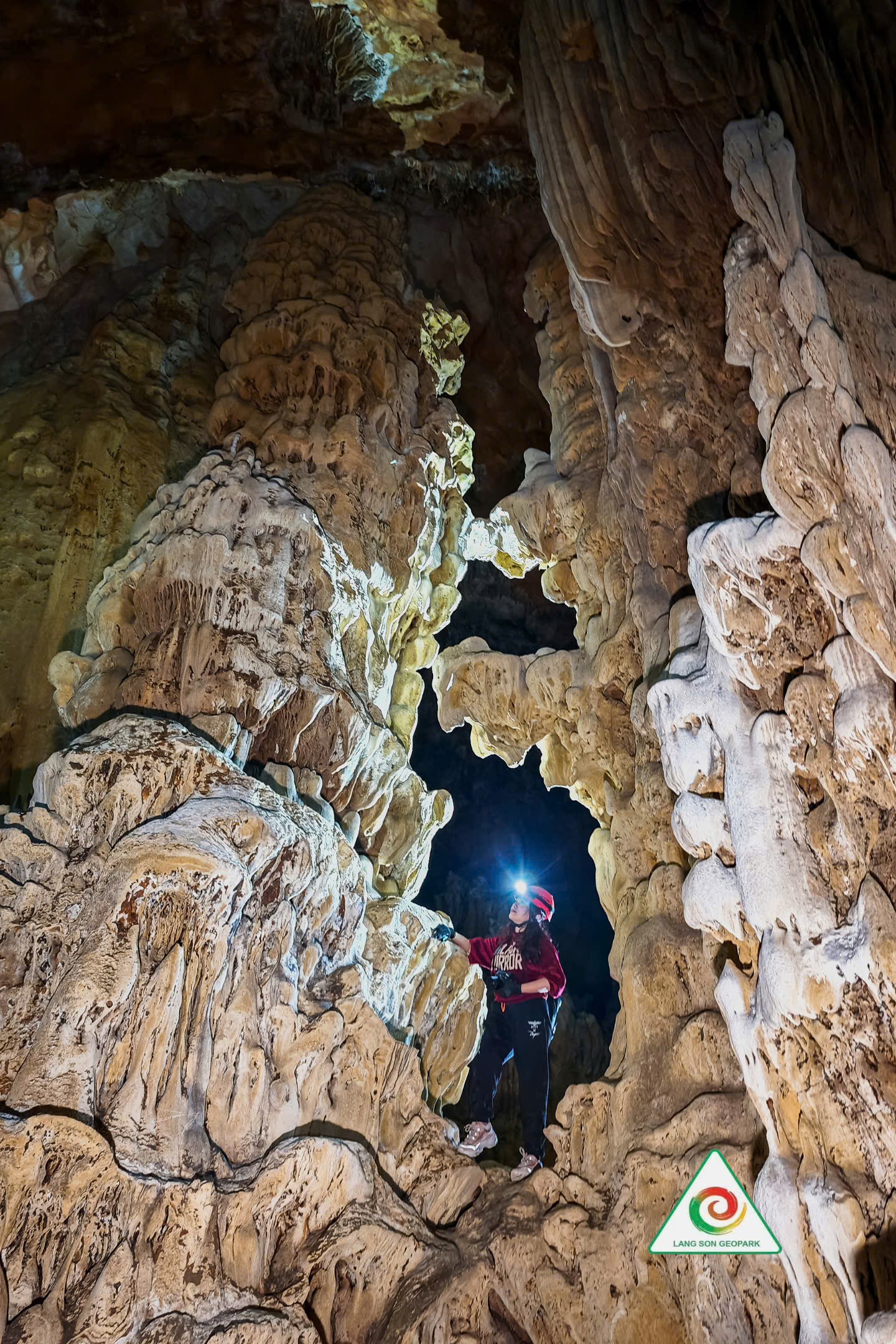
Nguom Mooc Cave, Mong An Commune - Binh Gia District: The cave entrance is located halfway up the limestone mountain, about 25m wide and about 20m high, quite easy to access because it takes about 15 minutes to walk the field. Very suitable for organizing tourists to visit.
Below the cave entrance is a water cave, this is an underground cave with water flowing deep inside the cave, so the water source is very clear, suitable for experiential activities such as swimming and boating in the summer in the area in front of the cave.
Terrain and stalactite system in the cave: According to the initial preliminary survey, the terrain moving in the cave is quite complicated because the cave is divided two floors.
Floor 1: a stream terrain flowing inside the cave, the flow is not continuous, there are underground sections flowing in the rock cavities or flowing underground, this terrain is quite dangerous when organizing tourists to visit the cave because there are many dangerous hidden corners and pits.
Floor 2: a dry cave with rugged rocky terrain combined with giant stalactites, the stalactite system is strongly developed, however, many stalactites have been damaged. Moving in floor 2 is also quite dangerous when there are many pits, connecting to floor 1, as well as many vertical cliffs that can be dangerous for visitors when moving in the cave. Therefore, it is necessary to have a system of ropes, safe ladders and must be designed to suit the environment in the cave, avoiding the situation of breaking the natural environment in the cave.
In the second floor, there are also areas with extremely beautiful stalactites but are very vulnerable to invasion and need to be strictly protected such as Ngoc Dong, stalactites containing sparkling silicate crystals.
The survey team also discovered a large lake at the end of the cave, this lake has a diameter of about 30m and can be expanded during the rainy season when the water rises. The cave is still capable of extending through other chambers or opening a new branch, or leading to a new cave entrance. This is a point that needs further investigation to be able to develop and open more sightseeing routes and research to ensure safety.
Cave exit location: The cave entrance is located halfway up the mountain and to reach the cave exit, you have to crawl through a narrow horizontal gap of about 50 cm, this is a challenge as well as a quite interesting experience for visitors, but must be carefully researched to ensure the safety of visitors and avoid getting stuck when crawling through.
.jpg)
Dan Lai Cave, Binh Trung Commune, Cao Loc District: Located near the top of Ngo Thi Si's Poem Mountain, Khanh Khe Bridge and Ky Cung River (about 600m Khanh Khe Bridge, about 500m the Poem Mountain of Ngo Thi Si Governor and about 1.5km National Highway 1B in the trekking direction), creating an extremely spectacular scene for tourists to explore. On the trekking route to the cave entrance, visitors will also admire many beautiful scenes that are very suitable for adventurous activities. Dan Lai Cave has 2 cave entrances located close to each other, both of which are small cracks formed the cliff, so approaching the cave is quite dangerous, it is necessary to set up safety rope systems to ensure the safety of tourists participating in the exploration. This is a dry cave and is located high up, so the stalactite system will not be too diverse but still very intact because it is quite difficult to access, there are many conservation research and it is suitable for adventure tourism.
The terrain in the cave is also difficult to move and slippery due to the layers of mud formed during the development process, there are also many narrow crevices that must be climbed, so ensuring the safety of visitors when exploring must be especially focused on.
.jpg)
In general, Dan Lai Cave has all the conditions and potential to become a safe cave to organize adventure tours and explore the cave. Khanh Khe Bridge Site has a lot of potential to exploit and develop adventure tourism such as Trekking, Abseiling - Rock Climbing, Camping, Kayaking, SUP, Cliff Climbing.
.jpg)
In addition, through field surveys and preliminary assessments using satellite images, Nguom Mooc Cave, Binh Gia district may be located in a chain of caves and sinkholes in Mong An and Hoang Van Thu communes, Binh Gia district, with great potential to attract adventure and exploration tourists.
.jpg)

Sinkhole No. 1 in Mong An commune, Binh Gia district - at the bottom of the Sinkhole there is a very beautiful cave
.jpg)
Sinkhole No. 2 in Hoang Van Thu commune, Binh Gia district
Some other natural masterpieces of Lang Son Geopark
.jpg)
.jpg)
.jpg)

.jpg)
.jpg)
.jpg)
.jpg)
In 2025 Lang Son Geopark will closely cooperate with Viet Nam Expeditions, Na Lay Adventure, other travel agents and experts to survey some of 200 caves, sinkholes, waterfalls to develop unique geotourism in Lang Son Geopark.
Lang Son Geopark Management Division (Lang Son Provincial Agency for Investment, Trade and Tourism Promotion)
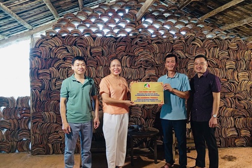
Enterprises accompany the construction and development of Lang Son UNESCO Global Geopark, Lang Son province, Viet Nam

Exploring and mapping Nguom Mooc Cave, Tham Lum Sinkhole, Mong An Commune, Binh Gia District (Lang Son Geopark Tourist Route No. 02), Lang Son province, Viet Nam)

Surveying and consultation on the formation of geotourism products in Lang Son Geopark area at Sinkhole 02 in Hoang Van Thu commune, Binh Gia district, Lang Son province, Vietnam